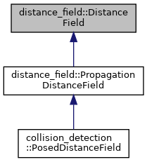
DistanceField is an abstract base class for computing distances from sets of 3D obstacle points. The distance assigned to a freespace cell should be the distance to the closest obstacle cell. Cells that are obstacle cells should either be marked as zero distance, or may have a negative distance if a signed version of the distance field is being used and an obstacle point is internal to an obstacle volume. More...
#include <distance_field.hpp>
Public Member Functions | |
| DistanceField (double size_x, double size_y, double size_z, double resolution, double origin_x, double origin_y, double origin_z) | |
| Constructor, where units are arbitrary but are assumed to be meters. | |
| virtual | ~DistanceField () |
| virtual void | addPointsToField (const EigenSTL::vector_Vector3d &points)=0 |
| Add a set of obstacle points to the distance field, updating distance values accordingly. The distance field may already contain obstacle cells. | |
| virtual void | removePointsFromField (const EigenSTL::vector_Vector3d &points)=0 |
| Remove a set of obstacle points from the distance field, updating distance values accordingly. | |
| virtual void | updatePointsInField (const EigenSTL::vector_Vector3d &old_points, const EigenSTL::vector_Vector3d &new_points)=0 |
| This function will remove any obstacle points that are in the old point set but not the new point set, and add any obstacle points that are in the new block set but not the old block set. Any points that are in both sets are left unchanged. | |
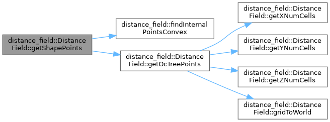
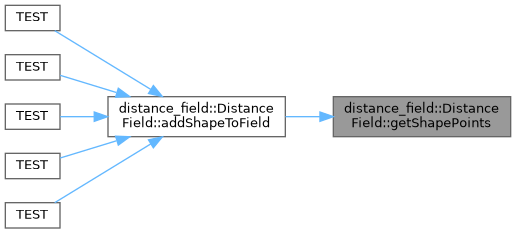
| bool | getShapePoints (const shapes::Shape *shape, const Eigen::Isometry3d &pose, EigenSTL::vector_Vector3d *points) const |
| Get the points associated with a shape. This is mainly used when the external application needs to cache points. | |
| void | addShapeToField (const shapes::Shape *shape, const Eigen::Isometry3d &pose) |
| Adds the set of points corresponding to the shape at the given pose as obstacle points into the distance field. If the shape is an OcTree, the pose information is ignored and the OcTree is passed to the addOcTreeToField function. | |
| void | addOcTreeToField (const octomap::OcTree *octree) |
| Adds an octree to the distance field. Cells that are occupied in the octree that lie within the voxel grid are added to the distance field. The octree can represent either a larger or smaller volume than the distance field. If the resolution of the octree is less than or equal to the resolution of the distance field then the center of each leaf cell of the octree will be added to the distance field. If the resolution of the octree is greater than a 3D volume of the correct resolution will be added for each occupied leaf node. | |
| void | moveShapeInField (const shapes::Shape *shape, const Eigen::Isometry3d &old_pose, const Eigen::Isometry3d &new_pose) |
| Moves the shape in the distance field from the old pose to the new pose, removing points that are no longer obstacle points, and adding points that are now obstacle points at the new pose. This function will discretize both shapes, and call the updatePointsInField function on the old and new point sets. | |
| void | removeShapeFromField (const shapes::Shape *shape, const Eigen::Isometry3d &pose) |
| All points corresponding to the shape are removed from the distance field. | |
| virtual void | reset ()=0 |
| Resets all points in the distance field to an uninitialize value. | |
| virtual double | getDistance (double x, double y, double z) const =0 |
| Gets the distance to the closest obstacle at the given location. The particulars of this function are heavily dependent on the behavior of the derived class. | |
| double | getDistanceGradient (double x, double y, double z, double &gradient_x, double &gradient_y, double &gradient_z, bool &in_bounds) const |
| Gets not only the distance to the nearest cell but the gradient direction. The gradient is computed as a function of the distances of near-by cells. An uninitialized distance is returned if the cell is not valid for gradient production purposes. The gradient is pointing out of the obstacle - thus to recover the closest obstacle point, the normalized gradient value is multiplied by the distance and subtracted from the cell's location, as shown below. | |
| virtual double | getDistance (int x, int y, int z) const =0 |
| Gets the distance to the closest obstacle at the given integer cell location. The particulars of this function are heavily dependent on the behavior of the derived class. | |
| virtual bool | isCellValid (int x, int y, int z) const =0 |
| Determines whether or not the cell associated with the supplied indices is valid for this distance field. | |
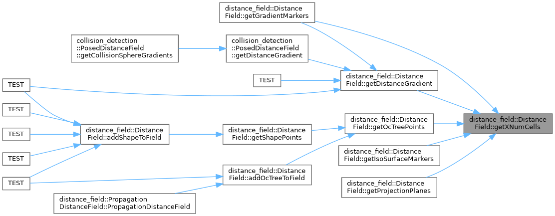
| virtual int | getXNumCells () const =0 |
| Gets the number of cells along the X axis. | |
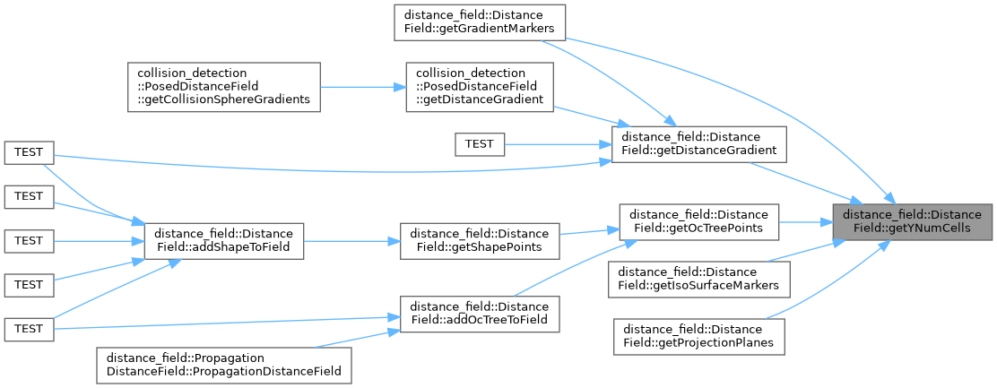
| virtual int | getYNumCells () const =0 |
| Gets the number of cells along the Y axis. | |
| virtual int | getZNumCells () const =0 |
| Gets the number of cells along the Z axis. | |
| virtual bool | gridToWorld (int x, int y, int z, double &world_x, double &world_y, double &world_z) const =0 |
| Converts from an set of integer indices to a world location given the origin and resolution parameters. | |
| virtual bool | worldToGrid (double world_x, double world_y, double world_z, int &x, int &y, int &z) const =0 |
| Converts from a world location to a set of integer indices. Should return false if the world location is not valid in the distance field, and should populate the index values in either case. | |
| virtual bool | writeToStream (std::ostream &stream) const =0 |
| Writes the contents of the distance field to the supplied stream. | |
| virtual bool | readFromStream (std::istream &stream)=0 |
| Reads, parameterizes, and populates the distance field based on the supplied stream. | |
| void | getIsoSurfaceMarkers (double min_distance, double max_distance, const std::string &frame_id, const rclcpp::Time &stamp, visualization_msgs::msg::Marker &marker) const |
| Get an iso-surface for visualization in rviz. The iso-surface shows every cell that has a distance in a given range in the distance field. The cells are added as a visualization_msgs::msg::Marker::CUBE_LIST in the namespace "distance_field". | |
| void | getGradientMarkers (double min_radius, double max_radius, const std::string &frame_id, const rclcpp::Time &stamp, visualization_msgs::msg::MarkerArray &marker_array) const |
| Populates the supplied marker array with a series of arrows representing gradients of cells that are within the supplied range in terms of distance. The markers will be visualization_msgs::msg::Marker::ARROW in the namespace "distance_field_gradient". | |
| void | getPlaneMarkers (PlaneVisualizationType type, double length, double width, double height, const Eigen::Vector3d &origin, const std::string &frame_id, const rclcpp::Time &stamp, visualization_msgs::msg::Marker &marker) const |
| Populates a marker with a slice of the distance field in a particular plane. All cells in the plane will be added to the field, with colors associated with their distance. | |
| void | getProjectionPlanes (const std::string &frame_id, const rclcpp::Time &stamp, double max_distance, visualization_msgs::msg::Marker &marker) const |
| A function that populates the marker with three planes - one each along the XY, XZ, and YZ axes. For each of the planes, any column on that plane will be marked according to the minimum distance along that column. | |
| double | getSizeX () const |
| Gets the distance field size along the X dimension in meters. | |
| double | getSizeY () const |
| Gets the distance field size along the Y dimension in meters. | |
| double | getSizeZ () const |
| Gets the distance field size along the Z dimension in meters. | |
| double | getOriginX () const |
| Gets the origin (minimum value) along the X dimension. | |
| double | getOriginY () const |
| Gets the origin (minimum value) along the Y dimension. | |
| double | getOriginZ () const |
| Gets the origin (minimum value) along the Z dimension. | |
| double | getResolution () const |
| Gets the resolution of the distance field in meters. | |
| virtual double | getUninitializedDistance () const =0 |
| Gets a distance value for an invalid cell. | |
Protected Member Functions | |
| void | getOcTreePoints (const octomap::OcTree *octree, EigenSTL::vector_Vector3d *points) const |
| Get the points associated with an octree. | |
| void | setPoint (int xCell, int yCell, int zCell, double dist, geometry_msgs::msg::Point &point, std_msgs::msg::ColorRGBA &color, double max_distance) const |
| Helper function that sets the point value and color given the distance. | |
Protected Attributes | |
| double | size_x_ |
| X size of the distance field. | |
| double | size_y_ |
| Y size of the distance field. | |
| double | size_z_ |
| Z size of the distance field. | |
| double | origin_x_ |
| X origin of the distance field. | |
| double | origin_y_ |
| Y origin of the distance field. | |
| double | origin_z_ |
| Z origin of the distance field. | |
| double | resolution_ |
| Resolution of the distance field. | |
| int | inv_twice_resolution_ |
| Computed value 1.0/(2.0*resolution_) | |
Detailed Description
DistanceField is an abstract base class for computing distances from sets of 3D obstacle points. The distance assigned to a freespace cell should be the distance to the closest obstacle cell. Cells that are obstacle cells should either be marked as zero distance, or may have a negative distance if a signed version of the distance field is being used and an obstacle point is internal to an obstacle volume.
Inherited classes must contain methods for holding a dense set of 3D voxels as well as methods for computing the required distances. The distance field parent class doesn't hold the data or have any way to generate distances from that data.
Definition at line 92 of file distance_field.hpp.
Constructor & Destructor Documentation
◆ DistanceField()
| distance_field::DistanceField::DistanceField | ( | double | size_x, |
| double | size_y, | ||
| double | size_z, | ||
| double | resolution, | ||
| double | origin_x, | ||
| double | origin_y, | ||
| double | origin_z | ||
| ) |
Constructor, where units are arbitrary but are assumed to be meters.
- Parameters
-
[in] size_x The X dimension in meters of the volume to represent [in] size_y The Y dimension in meters of the volume to represent [in] size_z The Z dimension in meters of the volume to represent [in] resolution The resolution in meters of the volume [in] origin_x The minimum X point of the volume [in] origin_y The minimum Y point of the volume [in] origin_z The minimum Z point of the volume
Definition at line 58 of file distance_field.cpp.
◆ ~DistanceField()
|
virtualdefault |
Member Function Documentation
◆ addOcTreeToField()
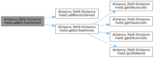
| void distance_field::DistanceField::addOcTreeToField | ( | const octomap::OcTree * | octree | ) |
Adds an octree to the distance field. Cells that are occupied in the octree that lie within the voxel grid are added to the distance field. The octree can represent either a larger or smaller volume than the distance field. If the resolution of the octree is less than or equal to the resolution of the distance field then the center of each leaf cell of the octree will be added to the distance field. If the resolution of the octree is greater than a 3D volume of the correct resolution will be added for each occupied leaf node.
- Parameters
-
[in] octree The octree to add to the distance field
Definition at line 286 of file distance_field.cpp.

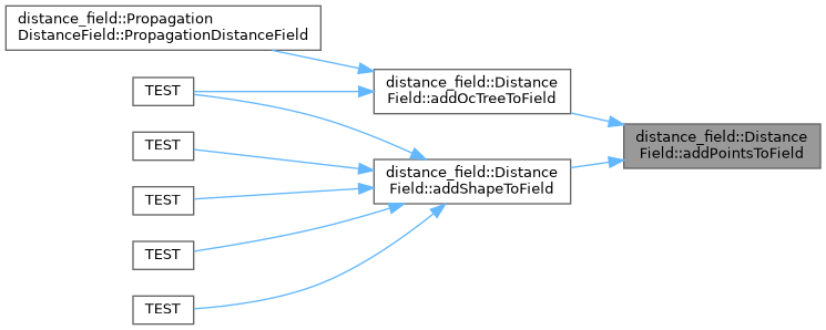
◆ addPointsToField()
|
pure virtual |
Add a set of obstacle points to the distance field, updating distance values accordingly. The distance field may already contain obstacle cells.
- Parameters
-
[in] points The set of obstacle points to add
Implemented in distance_field::PropagationDistanceField.
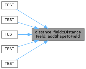
◆ addShapeToField()
| void distance_field::DistanceField::addShapeToField | ( | const shapes::Shape * | shape, |
| const Eigen::Isometry3d & | pose | ||
| ) |
Adds the set of points corresponding to the shape at the given pose as obstacle points into the distance field. If the shape is an OcTree, the pose information is ignored and the OcTree is passed to the addOcTreeToField function.
This function uses the Body class in the geometric_shapes package to determine the set of obstacle points, with the exception of OcTrees as mentioned. A bounding sphere is computed given the shape; the bounding sphere is iterated through in 3D at the resolution of the distance_field, with each point tested for point inclusion. For more information about the behavior of bodies and poses please see the documentation for geometric_shapes.
- Parameters
-
[in] shape The shape to add to the distance field [in] pose The pose of the shape
Definition at line 233 of file distance_field.cpp.

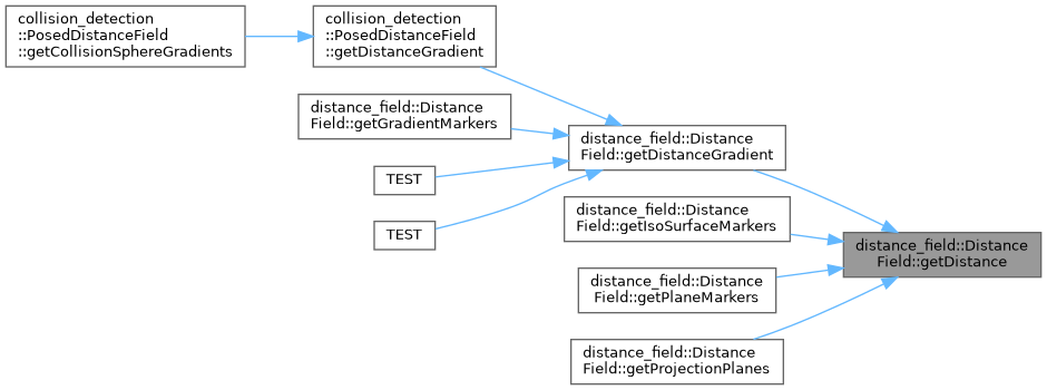
◆ getDistance() [1/2]
|
pure virtual |
Gets the distance to the closest obstacle at the given location. The particulars of this function are heavily dependent on the behavior of the derived class.
The particular implementation may return a max distance value if a cell is far away from all obstacles. Values of 0.0 should represent that a cell is an obstacle, and some implementations may return a signed value representing distance to the surface when a cell is deep inside an obstacle volume. An implementation may also return some value to represent when a location is outside the represented volume.
- Parameters
-
[in] x The cell's X value [in] y The cell's Y value [in] z The cell's Z value
- Returns
- The distance to the closest obstacle cell
Implemented in distance_field::PropagationDistanceField.
◆ getDistance() [2/2]
|
pure virtual |
Gets the distance to the closest obstacle at the given integer cell location. The particulars of this function are heavily dependent on the behavior of the derived class.
- Parameters
-
[in] x The X index of the cell [in] y The Y index of the cell [in] z The Z index of the cell
- Returns
- The distance to the closest occupied cell
Implemented in distance_field::PropagationDistanceField.
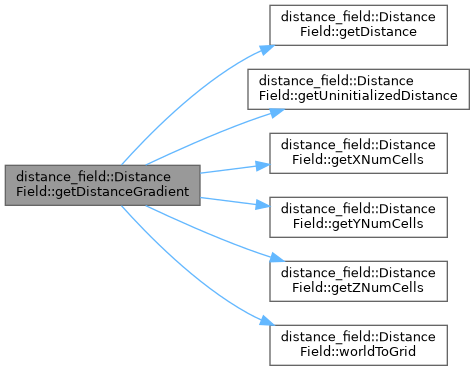
◆ getDistanceGradient()
| double distance_field::DistanceField::getDistanceGradient | ( | double | x, |
| double | y, | ||
| double | z, | ||
| double & | gradient_x, | ||
| double & | gradient_y, | ||
| double & | gradient_z, | ||
| bool & | in_bounds | ||
| ) | const |
Gets not only the distance to the nearest cell but the gradient direction. The gradient is computed as a function of the distances of near-by cells. An uninitialized distance is returned if the cell is not valid for gradient production purposes. The gradient is pointing out of the obstacle - thus to recover the closest obstacle point, the normalized gradient value is multiplied by the distance and subtracted from the cell's location, as shown below.
A number of different cells will not have valid gradients. Any cell that is entirely surrounded by cells of the same distance will not have a valid gradient. Depending on the implementation of the distance field, such cells may be found far away from obstacles (if a distance is not computed for every cell), or deep within obstacles. Such points can be detected as having zero magnitude for the gradient.
The closest cell to a given cell can be computed given the following formulation (this value will only be within the resolution parameter of the correct location), including a test for a non-zero gradient magnitude:
- Parameters
-
[in] x The X location of the cell [in] y The X location of the cell [in] z The X location of the cell [out] gradient_x The X component of the gradient to the closest occupied cell [out] gradient_y The Y component of the gradient to the closest occupied cell [out] gradient_z The Z component of the gradient to the closest occupied cell [out] in_bounds Whether or not the (x,y,z) is valid for gradient purposes. Gradients are not valid at the boundary of the distance field (cells where one or more of the indexes are at 0 or at the maximum size).
- Returns
- The distance to the closest occupied cell
Definition at line 73 of file distance_field.cpp.

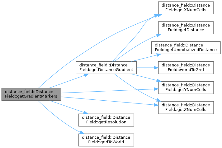
◆ getGradientMarkers()
| void distance_field::DistanceField::getGradientMarkers | ( | double | min_radius, |
| double | max_radius, | ||
| const std::string & | frame_id, | ||
| const rclcpp::Time & | stamp, | ||
| visualization_msgs::msg::MarkerArray & | marker_array | ||
| ) | const |
Populates the supplied marker array with a series of arrows representing gradients of cells that are within the supplied range in terms of distance. The markers will be visualization_msgs::msg::Marker::ARROW in the namespace "distance_field_gradient".
- Parameters
-
[in] min_distance Cells of less than this distance will not be added to the marker [in] max_distance Cells of greater than this distance will not be added to the marker [in] frame_id The frame to use as the header in the marker [in] stamp The stamp to use in the header of the marker [out] marker_array The marker array to populate
Definition at line 143 of file distance_field.cpp.
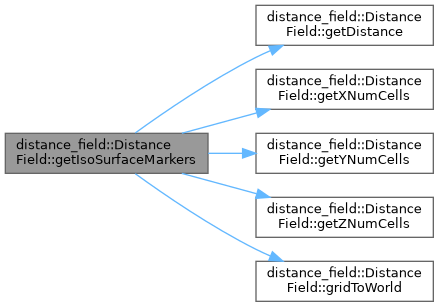
◆ getIsoSurfaceMarkers()
| void distance_field::DistanceField::getIsoSurfaceMarkers | ( | double | min_distance, |
| double | max_distance, | ||
| const std::string & | frame_id, | ||
| const rclcpp::Time & | stamp, | ||
| visualization_msgs::msg::Marker & | marker | ||
| ) | const |
Get an iso-surface for visualization in rviz. The iso-surface shows every cell that has a distance in a given range in the distance field. The cells are added as a visualization_msgs::msg::Marker::CUBE_LIST in the namespace "distance_field".
- Parameters
-
[in] min_distance Cells of less than this distance will not be added to the marker [in] max_distance Cells of greater than this distance will not be added to the marker [in] frame_id The frame to use as the header in the marker [in] stamp The stamp to use in the header of the marker [out] marker The marker that will contain the indicated cells.
Definition at line 99 of file distance_field.cpp.
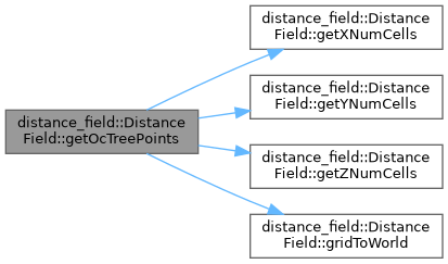
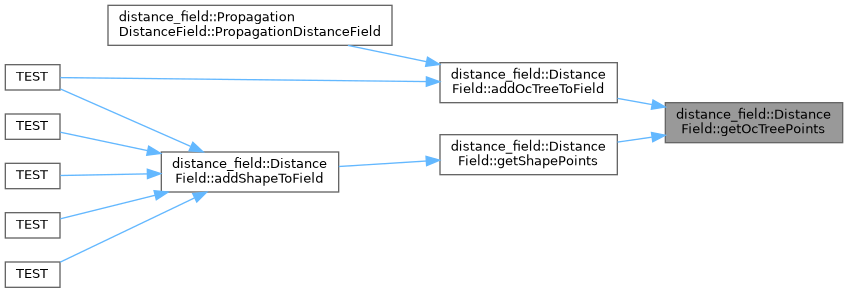
◆ getOcTreePoints()
|
protected |
Get the points associated with an octree.
- Parameters
-
[in] octree The octree to find points for. [out] points The points determined for this octree.
Definition at line 240 of file distance_field.cpp.
◆ getOriginX()
|
inline |
Gets the origin (minimum value) along the X dimension.
- Returns
- The X origin
Definition at line 535 of file distance_field.hpp.
◆ getOriginY()
|
inline |
Gets the origin (minimum value) along the Y dimension.
- Returns
- The Y origin
Definition at line 546 of file distance_field.hpp.
◆ getOriginZ()
|
inline |
Gets the origin (minimum value) along the Z dimension.
- Returns
- The Z origin
Definition at line 557 of file distance_field.hpp.
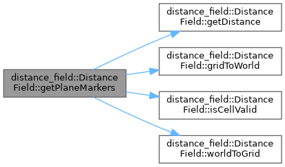
◆ getPlaneMarkers()
| void distance_field::DistanceField::getPlaneMarkers | ( | PlaneVisualizationType | type, |
| double | length, | ||
| double | width, | ||
| double | height, | ||
| const Eigen::Vector3d & | origin, | ||
| const std::string & | frame_id, | ||
| const rclcpp::Time & | stamp, | ||
| visualization_msgs::msg::Marker & | marker | ||
| ) | const |
Populates a marker with a slice of the distance field in a particular plane. All cells in the plane will be added to the field, with colors associated with their distance.
- Parameters
-
[in] type Which plane to show in the marker [in] length The length of the plane to show. If the type is XZ or XY, it's interpreted as the dimension along the X axis. If the type is YZ, it's interpreted along the Y axis. [in] width The width of the plane to show. If the type is XZ or YZ, it's interpreted along the Z axis. If the type is XY, it's interpreted along the Y axis. [in] height The height of the plane to show. If the type is XY, it's interpreted along the Z axis. If the type is XZ, it's interpreted along the Y axis. If the type is YZ, it's interpreted along the X axis. [in] origin The minimum point along each axis to display [in] frame_id The frame to use as the header in the marker [in] stamp The stamp to use in the header of the marker [out] marker The marker that will contain the indicated cells.
Definition at line 326 of file distance_field.cpp.
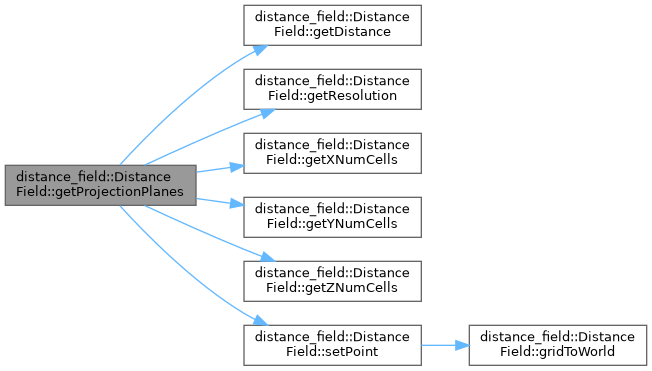
◆ getProjectionPlanes()
| void distance_field::DistanceField::getProjectionPlanes | ( | const std::string & | frame_id, |
| const rclcpp::Time & | stamp, | ||
| double | max_distance, | ||
| visualization_msgs::msg::Marker & | marker | ||
| ) | const |
A function that populates the marker with three planes - one each along the XY, XZ, and YZ axes. For each of the planes, any column on that plane will be marked according to the minimum distance along that column.
- Parameters
-
[in] frame_id The frame to use as the header in the marker [in] stamp The stamp to use in the header of the marker [in] max_distance A max distance for color calculation. Distances of this value or greater will show up as fully white in the marker. [out] marker The marker, which will be populated with a visualization_msgs::msg::Marker::CUBE_LIST .
Definition at line 452 of file distance_field.cpp.
◆ getResolution()
|
inline |
Gets the resolution of the distance field in meters.
- Returns
- The resolution of the distance field in meters
Definition at line 568 of file distance_field.hpp.

◆ getShapePoints()
| bool distance_field::DistanceField::getShapePoints | ( | const shapes::Shape * | shape, |
| const Eigen::Isometry3d & | pose, | ||
| EigenSTL::vector_Vector3d * | points | ||
| ) | const |
Get the points associated with a shape. This is mainly used when the external application needs to cache points.
- Parameters
-
[in] shape The shape to find points for. [in] pose The pose of the shape. [out] points The points determined for this shape.
Definition at line 208 of file distance_field.cpp.
◆ getSizeX()
|
inline |
Gets the distance field size along the X dimension in meters.
- Returns
- The size along the X dimension in meters
Definition at line 502 of file distance_field.hpp.
◆ getSizeY()
|
inline |
Gets the distance field size along the Y dimension in meters.
- Returns
- The size along the Y dimension in meters
Definition at line 513 of file distance_field.hpp.
◆ getSizeZ()
|
inline |
Gets the distance field size along the Z dimension in meters.
- Returns
- The size along the Z dimension in meters
Definition at line 524 of file distance_field.hpp.
◆ getUninitializedDistance()
|
pure virtual |
Gets a distance value for an invalid cell.
- Returns
- The distance associated with an uninitialized cell
Implemented in distance_field::PropagationDistanceField.

◆ getXNumCells()
|
pure virtual |
Gets the number of cells along the X axis.
- Returns
- The number of cells along the X axis
Implemented in distance_field::PropagationDistanceField.
◆ getYNumCells()
|
pure virtual |
Gets the number of cells along the Y axis.
- Returns
- The number of cells along the Y axis
Implemented in distance_field::PropagationDistanceField.
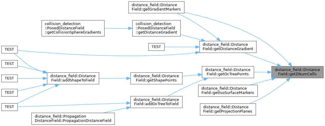
◆ getZNumCells()
|
pure virtual |
Gets the number of cells along the Z axis.
- Returns
- The number of cells along the Z axis
Implemented in distance_field::PropagationDistanceField.
◆ gridToWorld()
|
pure virtual |
Converts from an set of integer indices to a world location given the origin and resolution parameters.
- Parameters
-
[in] x The integer X location [in] y The integer Y location [in] z The integer Z location [out] world_x The computed world X location [out] world_y The computed world X location [out] world_z The computed world X location
- Returns
- Whether or not the transformation is successful. An implementation may or may not choose to return false if the indicated cell is not valid for this distance field.
Implemented in distance_field::PropagationDistanceField.

◆ isCellValid()
|
pure virtual |
Determines whether or not the cell associated with the supplied indices is valid for this distance field.
- Parameters
-
[in] x The X index of the cell [in] y The Y index of the cell [in] z The Z index of the cell
- Returns
- True if the cell is valid, otherwise false.
Implemented in distance_field::PropagationDistanceField.

◆ moveShapeInField()
| void distance_field::DistanceField::moveShapeInField | ( | const shapes::Shape * | shape, |
| const Eigen::Isometry3d & | old_pose, | ||
| const Eigen::Isometry3d & | new_pose | ||
| ) |
Moves the shape in the distance field from the old pose to the new pose, removing points that are no longer obstacle points, and adding points that are now obstacle points at the new pose. This function will discretize both shapes, and call the updatePointsInField function on the old and new point sets.
It's important to note that this function has no semantic understanding of an object - this function may be called even if addShapeToField was not previously called. Furthermore, points will be removed even if they have been added by multiple different sources - a cup resting on a table that is moved make take a chunk out of the top of the table.
- Parameters
-
[in] shape The shape to move in the distance field [in] old_pose The old pose of the shape [in] new_pose The new pose of the shape
Definition at line 293 of file distance_field.cpp.


◆ readFromStream()
|
pure virtual |
Reads, parameterizes, and populates the distance field based on the supplied stream.
- Parameters
-
[in] stream The stream from which to read
- Returns
- True if reading, parameterizing, and populating the distance field is successful; otherwise False.
Implemented in distance_field::PropagationDistanceField.
◆ removePointsFromField()
|
pure virtual |
Remove a set of obstacle points from the distance field, updating distance values accordingly.
This function will invalidate the distance measurements associated with the obstacle points and recompute them. Depending on the implementation of the derived class and the proportion of the total occupied points being removed, it may be more efficient to use the reset() function and add the remaining obstacle points to the grid again.
- Parameters
-
[in] points The set of obstacle points that will be set as free
Implemented in distance_field::PropagationDistanceField.

◆ removeShapeFromField()
| void distance_field::DistanceField::removeShapeFromField | ( | const shapes::Shape * | shape, |
| const Eigen::Isometry3d & | pose | ||
| ) |
All points corresponding to the shape are removed from the distance field.
The points needs not have been added using addShapeToField.
- Parameters
-
[in] shape The shape to remove from the distance field [in] pose The pose of the shape to remove
Definition at line 314 of file distance_field.cpp.


◆ reset()
|
pure virtual |
Resets all points in the distance field to an uninitialize value.
Implemented in distance_field::PropagationDistanceField.
◆ setPoint()
|
protected |
Helper function that sets the point value and color given the distance.
- Parameters
-
[in] xCell The x index of the cell [in] yCell The y index of the cell [in] zCell The z index of the cell [in] dist The distance of the cell [out] point World coordinates will be placed here [out] color A color will be assigned here that's only red if the distance is 0, and gets progressively whiter as the dist value approaches max_distance. [in] max_distance The distance past which all cells will be fully white
Definition at line 437 of file distance_field.cpp.


◆ updatePointsInField()
|
pure virtual |
This function will remove any obstacle points that are in the old point set but not the new point set, and add any obstacle points that are in the new block set but not the old block set. Any points that are in both sets are left unchanged.
The primary use case for this function is in moving objects - calculating the set of points associated with an object, moving the object in space, and calculating the new set of points. If the object has moved substantially, such that the old object position does not overlap with the new object position, then it may be more efficient to call removePointsFromField on the old points and addPointsToField on the new points. If the object has moved only slightly, however, this function may offer a speed improvement. All points in the old_points set should have been previously added to the field in order for this function to act as intended - points that are in both the old_points set and the new_points set will not be added to the field, as they are assumed to already be obstacle points.
- Parameters
-
[in] old_points The set of points that all should be obstacle cells in the distance field [in] new_points The set of points, all of which are intended to be obstacle points in the distance field
Implemented in distance_field::PropagationDistanceField.

◆ worldToGrid()
|
pure virtual |
Converts from a world location to a set of integer indices. Should return false if the world location is not valid in the distance field, and should populate the index values in either case.
- Parameters
-
[in] world_x The world X location [in] world_y The world Y location [in] world_z The world Z location [out] x The computed integer X location [out] y The computed integer X location [out] z The computed integer X location
- Returns
- True if all the world values result in integer indices that pass a validity check; otherwise False.
Implemented in distance_field::PropagationDistanceField.

◆ writeToStream()
|
pure virtual |
Writes the contents of the distance field to the supplied stream.
- Parameters
-
[out] stream The stream to which to write the distance field contents.
- Returns
- True if the writing is successful; otherwise, false.
Implemented in distance_field::PropagationDistanceField.
Member Data Documentation
◆ inv_twice_resolution_
|
protected |
Computed value 1.0/(2.0*resolution_)
Definition at line 614 of file distance_field.hpp.
◆ origin_x_
|
protected |
X origin of the distance field.
Definition at line 610 of file distance_field.hpp.
◆ origin_y_
|
protected |
Y origin of the distance field.
Definition at line 611 of file distance_field.hpp.
◆ origin_z_
|
protected |
Z origin of the distance field.
Definition at line 612 of file distance_field.hpp.
◆ resolution_
|
protected |
Resolution of the distance field.
Definition at line 613 of file distance_field.hpp.
◆ size_x_
|
protected |
X size of the distance field.
Definition at line 607 of file distance_field.hpp.
◆ size_y_
|
protected |
Y size of the distance field.
Definition at line 608 of file distance_field.hpp.
◆ size_z_
|
protected |
Z size of the distance field.
Definition at line 609 of file distance_field.hpp.
The documentation for this class was generated from the following files:
- moveit_core/distance_field/include/moveit/distance_field/distance_field.hpp
- moveit_core/distance_field/src/distance_field.cpp